During our short visit to La Palma, we didn't do much walking - partly because it really was short, partly because our kids are still not that keen on walking any distances at all, especially where going up is involved. And there is an awful lot of ups on La Palma - balanced by the eventual downs, but still. So, when we found ourselves on the top of the extremely steep cliff called El Time, and I saw a pointer to Puerto de Tazacorte, saying "3.2 km", I thought "yeaaah! finally, let's go, it's down and it's really close!".
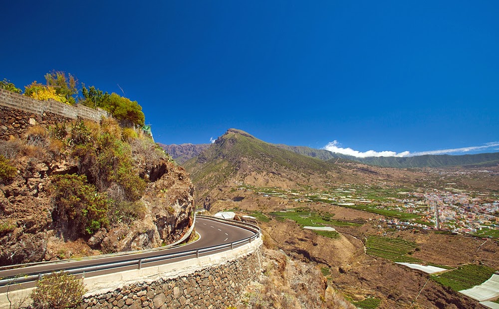
Yeah, right. "Down" bit was right, and so was the "really close", but I failed to take into the account how steeply down it was. The height of El Time is over 500 m, so if the angle was constant, it wouldn't be so bad - about 10 degrees, I think? Feel free to correct me. But. While the half of the journey down is reasonably even, you have to go down a near-vertical cliff face the second half. Sure, you don't climb down, there is a path with hairpin turns, but that doesn't make it any better if you are afraid of heights or that your kids accidentally take a wrong step while showing off like they do.
This write-up is just to show some pictures to warn you about the steepness of the walk, and one more problem - the almost complete lack of shade in the afternoon on the same steep bit. The path comes down to the sea level between two cafes on the promenade in Puerto de Tazacorte and I was mighty grateful when we eventually got there. I think it took about one hour and twenty minutes, but it felt a lot longer.
Apart from those two little things, everything is as advertised - great views of the beautiful island. We could see El Hierro outline on the horizon, but I don't think it's visible in the pictures.

One more thing worth noting - if you hate driving the mountain roads same way as I do, you can use the public transport. Look for the bus number 100 "Circunvalacion Norte", bus that goes around the north part of the island from Santa Cruz to Los Llanos de Aridane. Ask the driver for "El Time", the bus stop comes into view unexpectedly, especially if you are coming up from Los Llanos, or keep looking at you navigation device if you have one handy.
If you don't like the public transport, you can tackle those roads yourself. I prefer to trust the professionals. Plus, of course there is no necessity to come back and retrieve your car once you've finished your walk.

The deepest green in the pictures is provided by banana plantations - there is an awful lot of them everywhere. I mean an awful lot. Really.
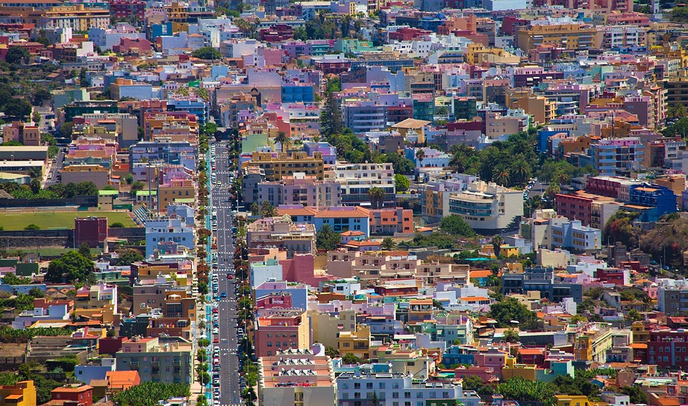
Lego bricks of Los Llanos de Aridane. It doesn't look like much, but it's a pleasant enough town - and the bus hub for the west of the island.
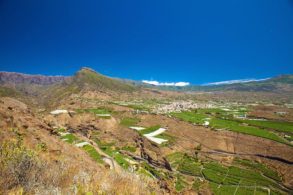
We didn't see the famous "bajada de los nubes", lowering of the clouds, when clouds start flowing over the mountain range. You can see where it's meant to be happening on the picture above, but it's not really there. Have a look here, it's a beautiful capture.

Some way down you start seeing Puerto de Tazacorte with its black sand beach below you. I don't know what is the origin of the stain in the ocean, I tend to think it is churned-up lighter colored sand particles.

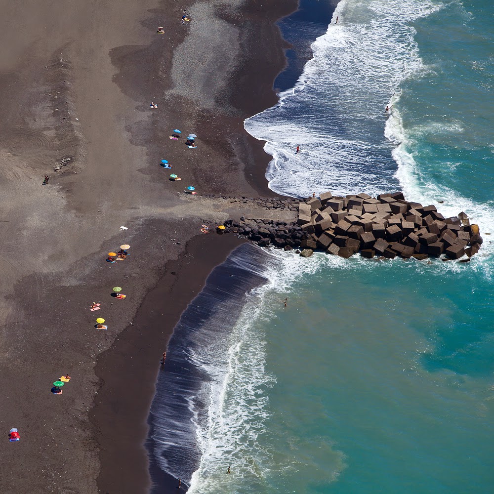
The dry and wet sand, the umbrellas, the foam and the angle give the beach nicely abstract look.
I honestly don't think there is any need for a route here. Find the pointer down, go down all the way, nice and simple. Or, if you are feeling reckless (read "suicidal"), find the one that points up to El Time on the north end of the promenade in Puerto de Tazacorte and go up. It's the same path that goes to the highest point of the island. Good luck :)


No comments:
Post a Comment